Lockdown, in theory, meant less but living in Dartmoor National Park it meant more and moor. With races cancelled I had no goals or aims. I was recovering from a tendon injury and was determined to rehab properly which meant building up slowly.
As I recovered I turned my attention to exploring my own backyard. Dartmoor is a wild open moorland with deep river valleys, a rich history and rare wildlife. It’s 368 square miles or 954 square kilometres. It’s about 20 miles from North to South and 20 miles from East to West. There is a book called the Dartmoor 365 which covers every square mile and explores what’s in them. I’m working my way through it.
The highest point on Dartmoor is High Willhays Tor at 621m or 2,039ft above sea level. The lowest point on Dartmoor is Doghole Bridge. It’s 30m or 98ft above sea level. Dartmoor is made up of 65% granite; rock which was created around 295 million years ago. Where the granite rock shows through they create Tors. Tors are landforms created by the erosion and weathering of rock. There are over 160 tors on Dartmoor. The shapes they make are all different and unusual.
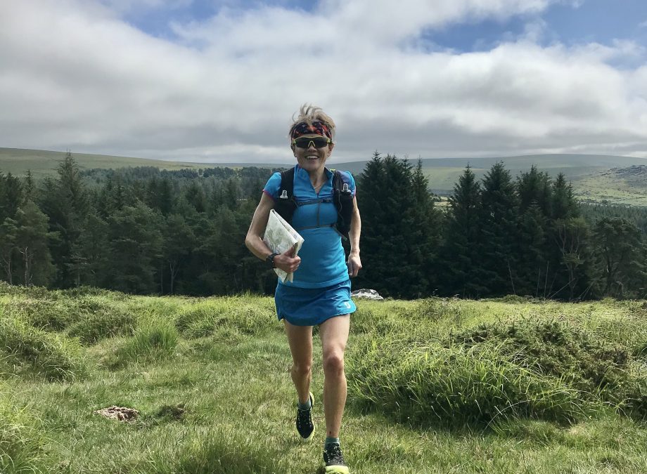
I love the history and the scenery. I wanted to really get to know it!
The first run planned was South to North. Jon and I ran the 30mile route based on the reverse of the route the Royal Marines used to run (in Jon’s day!). The Royal Marine recruits must complete it in 8hrs (7hrs for Officers) carrying 40Ilbs of kit (18kg) and rifles; impressive. We did Buckfastleigh to South Zeal so detoured off it at the start and the end for logistical reasons.

The second run we did was East to West; Moretonhampstead to Tavistock. It was 25miles with 1300m of elevation. The next day we ran back. I was on route selection map reading duties- some good, some bad – but essentially we Tor hopped as the crow flies. The sun shone and it was glorious to run cross Dartmoor, eat cake and not get wet feet.

The third run we did was Moretonhampstead to Lydford. It was 25miles with 1200m of elevation. It was a glorious route stepped in history; passing through a stone hut circle from the Bronze Age- around 1200BC.

I wanted to link up to the Lych Way which started near Postbridge and finished in Lydford. The Lych Way, ‘way of the dead’, history is set deep in the medieval days when every person on the moor was expected to attend their church for burials. This involved a walk of about 12 miles in good conditions and about 17miles in bad weather.
The fourth run was from Okehampton camp to Shaugh Prior, the current Royal Marines 30miler training run heading North to South.

The fifth run, on my birthday, was along the 23miles of the Abbots Way following the route taken by monks in the 11th century when they walked from Tavistock Abbey (974AD) to Buckfast Abbey (1018AD).

The sixth run I did was the Dartmoor half of the Two Moors Way (30 miles, 1330m). I did it with a friend, Siân Longthorpe. We started from Ivybridge and headed to Hameldown before veering off to Moretonhampstead.

Then other routes became apparent off the back of my developing fitness, strength and Dartmoor knowledge.
One such route being the Dartmoor Perambulation: In 1240 King Henry III ordered a writ, dated the June 13th, that the lands of his brother, Richard of Cornwall, should confirmed by a boundary perambulation. The lands in question were the Forest of Dartmoor and the Manor of Lydford which he had previously granted to Richard in 1239. It was decreed that the Sheriff of Devon and 12 “lawful knights of the country” should undertake the mission. Over two days Jon and I undertook the mission. 48miles, 2200m elevation and about 11hrs of run- walking, navigating and trampling across ground with some paths sometimes!

Day 1 South: Rundlestone, near Princetown, Siward’s Cross, Erme Head ford, Eastern White barrow (burial mound), Ryders Hill, Dartmeet, King’s Oven (near to the Warren House Inn).

Day 2 North: Watern Tor, Hound Tor, Cosdon, Cullever Steps, Yes Tor, Steng-a Tor, Rattle Brook, Lynch Tor, Great Mis Tor and back to Rundlestone.


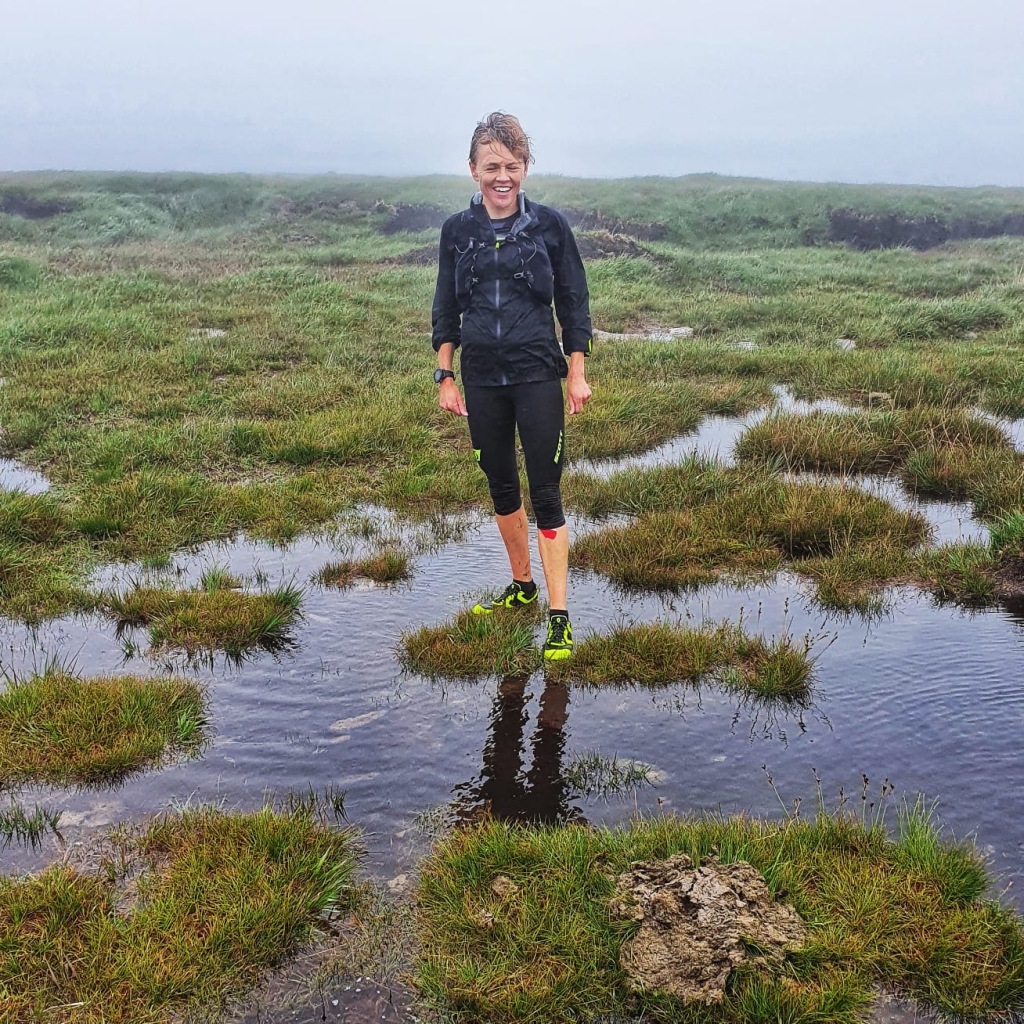
Another such route was the Dartmoor 600’s which encompasses all 5 peaks over 600m (Cut Hill, Whitehorse Hill, Hangingstone Hill, High Wilhays, Yes Tor). It was 18miles and took 3hrs 11mins setting a new female Fastest Known Time (FKT). I did it in mizzly rain and fog but was accompanied by Jeremy Tandy who helped with the navigation- thanks.
Now I have one more challenge I want to do before the summer ends and racing resumes again. There is a route set by Nigel Jenkins in 1999 called the Dartmoor Round which he did on New Years Eve to celebrate the millennium making sure he got back to the pub before last orders. It’s 75miles around the Moor covering 28 Tors.
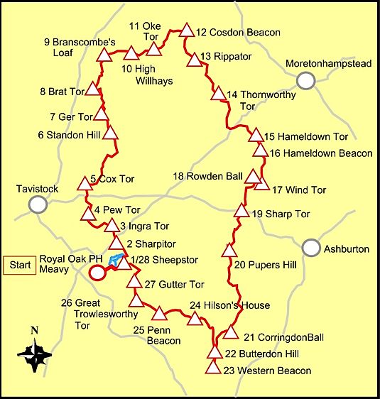
As I write this I am busy recceing it when I can.

I aim to do it mid August, in a good weather window!
Visit Jo’s blog here: jomeekblog.wordpress.com/2020/07/23/more-and-moor-lockdown-love-dartmoor/